
Advanced drone hardware, precision sensors, and analytical software — built for the industries we serve
FiosIQ combines two of the most advanced commercial drone platforms available with specialized sensors that capture data far beyond what the human eye can detect. But hardware is only part of the story. The real value is in how that data is processed, analyzed, and delivered — transforming thousands of raw aerial images into clear, prioritized intelligence that supports real decisions.
Every mission is planned around the client's specific asset, objective, and industry — ensuring the right sensor reaches the right site.
• Captures NDVI and multispectral data across sites
• Detects plant stress before visible on the ground
• Enables early intervention to protect yield
• Covers large areas quickly and efficiently
• Precision agriculture & pasture optimization
• Identifies irrigation inconsistencies
• Drives smarter decisions
• Lightweight and fast to deploy
• Ideal for vineyards and farmland
• Turns invisible patterns into insight
• Advanced thermal imaging for anomaly detection
• Identifies solar panel hotspots
• Detects roof and water intrusion issues
• Highlights HVAC performance problems
• Safe inspection of hazardous areas
• Reduces need for manual access
• Rapid data capture across large assets
• Ideal for infrastructure and insurance
• Supports faster decision-making
• Prevents costly failures
• Processes raw data into visual intelligence
• Generates NDVI and thermal maps
• Identifies patterns and performance gaps
• Converts imagery into measurable outputs
• Enables comparison and trend analysis
• Delivers clean, easy reports
• Supports 24–72 hour turnaround
• Removes guesswork
• Scalable across industries
• Transforms data into action
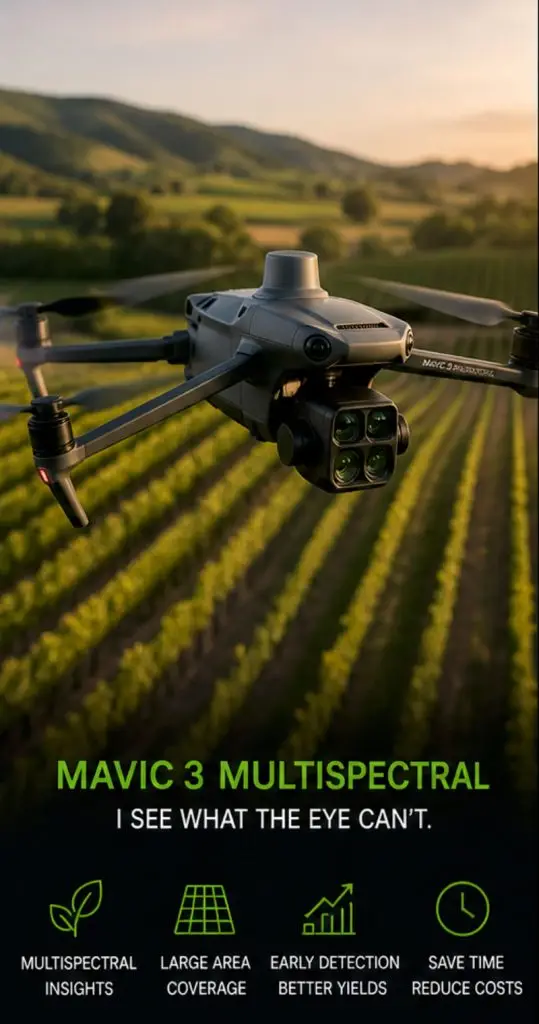
Precision Agriculture · Crop Intelligence
Think of it as a tireless field scout with extraordinary vision. Equipped with powerful multispectral sensors and high-resolution imaging, it sees far beyond what the human eye can detect — identifying early indicators of crop stress, disease, and variability long before visible symptoms appear. RTK positioning maps every image with centimeter-level accuracy, down to individual vine rows and leaf-level variations in plant vigor.
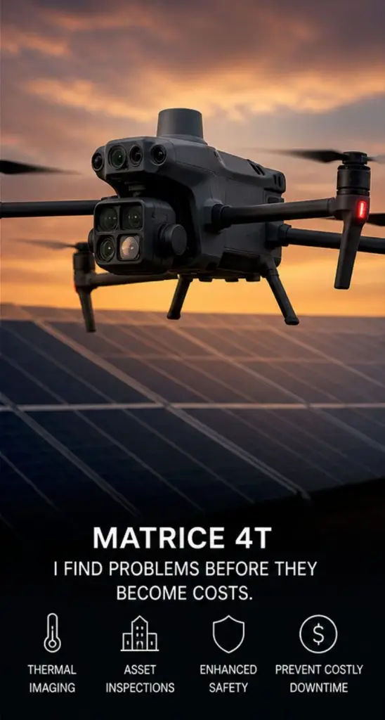
Thermal Inspection · Enterprise Sensing
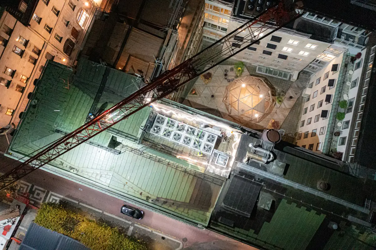
The inspection specialist of the fleet. At its core is a radiometric thermal camera capable of detecting subtle temperature differences that reveal issues long before they become visible failures — overheating panels, stressed electrical components, hidden fire hotspots, and structural defects. Combined with high-resolution visual and zoom cameras, the Matrice 4T inspects assets safely from distance while capturing the detail needed for precise analysis.
Each sensor type reveals a different dimension of your asset — combining them gives you a complete picture that no single method can match.
Captures light across multiple wavelengths beyond the visible spectrum — including Red Edge and Near Infrared (NIR) bands invisible to the human eye.
Why it matters
Plants reflect NIR light differently based on health. A stressed vine shows measurable changes in spectral reflectance weeks before visible symptoms appear — enabling intervention before damage is done.
Key output:
NDVI maps — color-coded stress zones, variability, and vigor across entire fields
Measures actual surface temperature across every pixel in the frame — not just hottest/coldest, but exact temperature values at every point.
Why it matters
Electrical faults, failing panels, and structural issues generate detectable heat signatures invisible to the naked eye. Radiometric data enables precise fault analysis — not just visual detection.
Key output:
Thermal maps with GPS-located hotspots, temperature differential reports, maintenance priority lists
Real-Time Kinematic GPS achieving centimeter-level spatial accuracy — far beyond what standard GPS can deliver.
Why it matters
Every image and data point is mapped to an exact location. This enables repeatable surveys season over season, precise GPS-stamped defect locations, and direct integration with GIS and engineering workflows.
Key output:
Geolocated data layers, accurate site maps, GPS-stamped defect coordinates
High-resolution wide-angle and zoom cameras capturing photographic-quality imagery of structures and assets from safe aerial distances.
Why it matters
Allows close inspection of rooftops, bridges, towers, and industrial facilities without requiring personnel to access hazardous environments — improving safety while reducing inspection cost.
Key output:
Annotated inspection imagery, before/after documentation, GPS-stamped structural photos
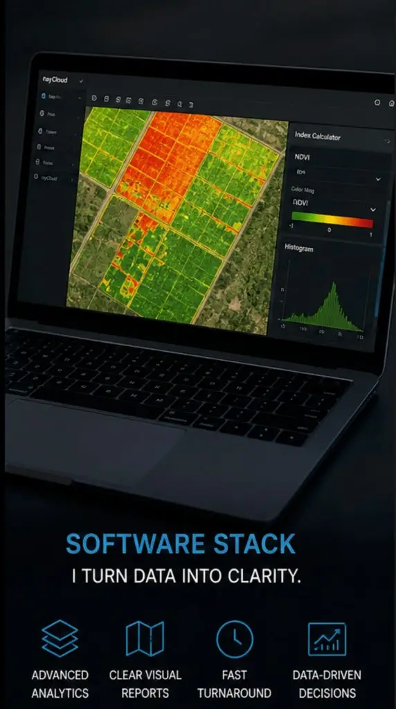
Capturing high-quality aerial data is the first step. The second — and equally important — step is transforming that raw imagery into intelligence that actually supports decisions. FiosIQ uses industry-leading analytical software and advanced mapping tools to process every dataset.

Color-coded vegetation health maps showing stress zones, variability, and early disease markers across crop rows.
Radiometric heat maps identifying hotspots, failing components, and temperature anomalies invisible to the naked eye.
Stitched, georeferenced aerial maps with centimeter-level accuracy for site documentation and asset records.
Annotated high-resolution imagery with GPS-located defect markers and before/after documentation.