
Advanced aerial data collection and analytics — purpose-built for Agriculture, Energy, Infrastructure, and Insurance
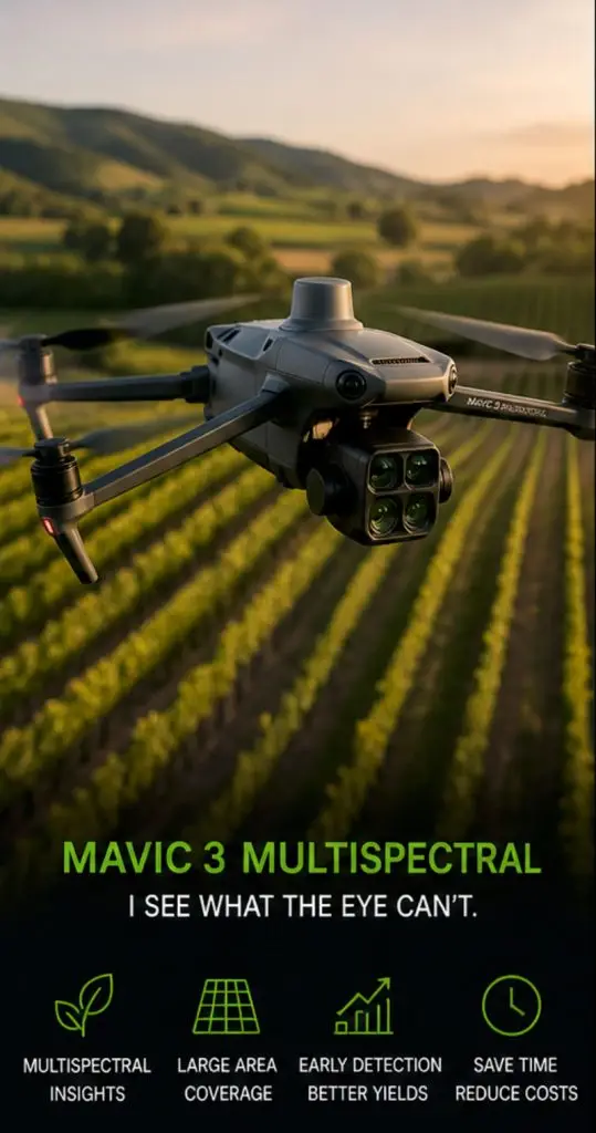
• Captures NDVI and multispectral data across sites
• Detects plant stress before visible on the ground
• Enables early intervention to protect yield
• Covers large areas quickly and efficiently
• Precision agriculture & pasture optimization
• Identifies irrigation inconsistencies
• Drives smarter decisions
• Lightweight and fast to deploy
• Ideal for vineyards and farmland
• Turns invisible patterns into insight
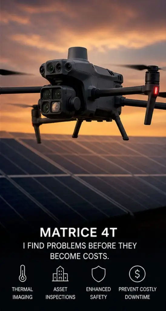
• Advanced thermal imaging for anomaly detection
• Identifies solar panel hotspots
• Detects roof and water intrusion issues
• Highlights HVAC performance problems
• Safe inspection of hazardous areas
• Reduces need for manual access
• Rapid data capture across large assets
• Ideal for infrastructure and insurance
• Supports faster decision-making
• Prevents costly failures
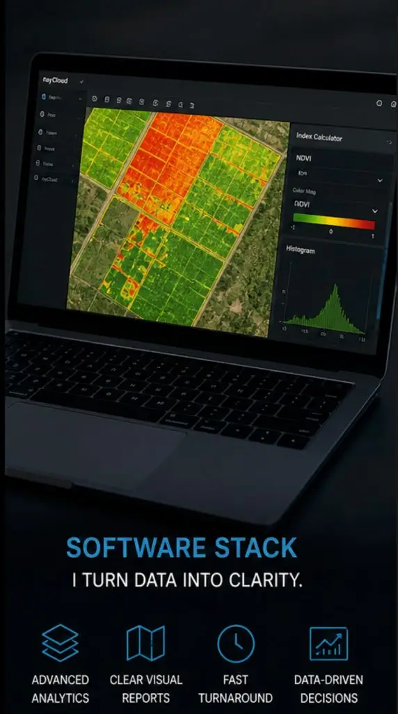
• Processes raw data into visual intelligence
• Generates NDVI and thermal maps
• Identifies patterns and performance gaps
• Converts imagery into measurable outputs
• Enables comparison and trend analysis
• Delivers clean, easy reports
• Supports 24–72 hour turnaround
• Removes guesswork
• Scalable across industries
• Transforms data into action
Precision Agriculture · Crop Intelligence
Think of it as a tireless field scout with extraordinary vision — scanning vineyards and farmland with an obsession for detail. It detects subtle changes in plant health long before visible symptoms appear, identifying early indicators of water stress, nutrient deficiencies, disease development, and uneven growth patterns.
Thermal Inspection · Enterprise Sensing
The inspection specialist of the fleet, built for demanding missions where precision and advanced sensing are essential. At its core is a radiometric thermal camera that detects subtle temperature differences — overheating solar panels, stressed electrical components, hidden fire hotspots, and structural defects — long before they become visible failures.