FiosIQ · Aerial Intelligence

Meet the Fleet

FiosIQ brings together advanced aerial technology and hands-on expertise to support better decision-making in the field.
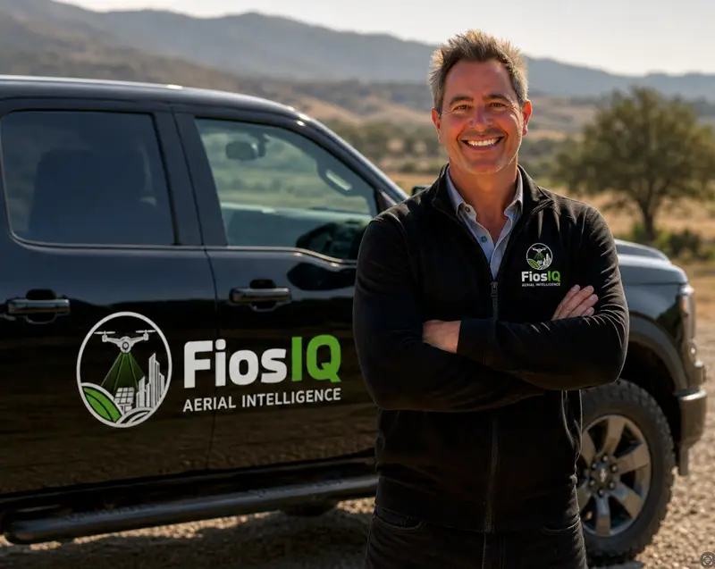
founder and data intelliegence specialist

Steve Thomson

Experience That Turns Data Into Smart Decisions.

• 20+ years in technology, operations, and program leadership
• Silicon Valley background in complex system deployment
• FAA Part 107 Certified Commercial Drone Pilot
• Combines field execution with strategic thinking
• Translates data into clear, actionable insights
• Focused on client outcomes — time, cost, and risk
• Structured problem-solving and precision execution
• Clear communication — no technical overwhelm
• Hands-on, accountable, and easy to work with
• Passion for sustainability and real-world impact

20 Years

Experience – Technology & Operations

FAA Licensed & Certified

Commercial Drone Pilot

Core industries

Agriculture • Solar • Infrastructure • Insurance

the WorkHorse

MAVIC 3 MULTISPECTRAL

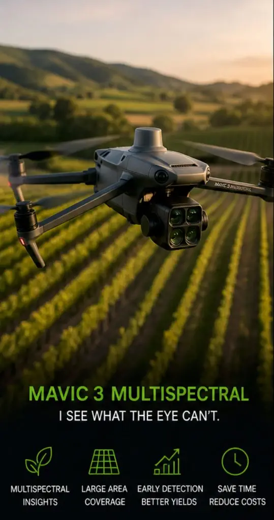
• Captures NDVI and multispectral data across sites
• Detects plant stress before visible on the ground
• Enables early intervention to protect yield
• Covers large areas quickly and efficiently
• Precision agriculture & pasture optimization
• Identifies irrigation inconsistencies
• Drives smarter decisions
• Lightweight and fast to deploy
• Ideal for vineyards and farmland
• Turns invisible patterns into insight

The Powerhouse

DJI Matrice 4T

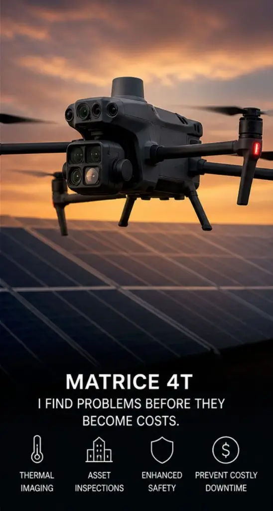
• Advanced thermal imaging for anomaly detection
• Identifies solar panel hotspots
• Detects roof and water intrusion issues
• Highlights HVAC performance problems
• Safe inspection of hazardous areas
• Reduces need for manual access
• Rapid data capture across large assets
• Ideal for infrastructure and insurance
• Supports faster decision-making
• Prevents costly failures

Where Data Becomes Insight

Software & Analysis

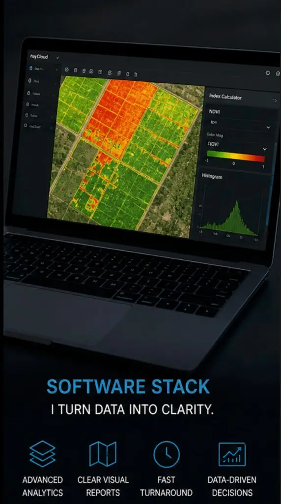
• Processes raw data into visual intelligence
• Generates NDVI and thermal maps
• Identifies patterns and performance gaps
• Converts imagery into measurable outputs
• Enables comparison and trend analysis
• Delivers clean, easy reports
• Supports 24–72 hour turnaround
• Removes guesswork
• Scalable across industries
• Transforms data into action

20+

Years in tech leadership

107

FAA Part certified

4

Industries served

The Operator

Steve Thomson

FiosIQ is led by a commercial drone pilot with a background in Silicon Valley technology leadership, bringing a structured, systems-driven approach to every project I take on.

I care deeply about the environments I work in — from vineyards and farmland to infrastructure and energy systems. Sustainability, responsible resource use, and supporting natural, organic growth aren’t just concepts — they guide how I apply technology in the field.

I believe drones should enhance human expertise, not replace it. They allow us to see more, act earlier, and operate more safely — reducing the need for manual inspection, minimizing disruption, and helping teams make better decisions with less impact.

I’m driven by a passion for robotics, aerospace, and real-world problem solving. Every project I take on is approached with precision, curiosity, and a focus on delivering clear, actionable insight.

Read more about Steve

With more than two decades of leadership experience in Silicon Valley’s technology sector, I have built my career around solving complex problems through innovation, analytics, and a deep commitment to customer success. Throughout my career, I have worked at the intersection of technology and business strategy—helping organizations leverage data, advanced tools, and emerging technologies to make smarter, faster decisions.

Today, I bring that same mindset to aerial intelligence and drone-based data solutions.As a licensed FAA Part 107 commercial drone pilot, I founded FiosIQ to combine my background in technology, analytics, and operational leadership with the rapidly advancing capabilities of aerial data acquisition. By utilizing state-of-the-art drones equipped with thermal, multispectral, and high-resolution imaging systems, I help organizations capture insights that are simply impossible to detect from the ground.

These advanced sensors allow us to identify patterns, anomalies, and early warning signs that even a trained eye cannot easily see—whether it’s subtle crop stress in a vineyard, overheating solar panels, structural irregularities, or hidden damage following a fire or severe weather event. Early detection enables organizations to address issues sooner, reduce risk, and make better operational decisions.

At FiosIQ, aerial data collection is only the first step. We combine these high-precision datasets with industry-leading analytical software and advanced mapping tools to transform raw imagery into clear, actionable intelligence. The result is a customized information package tailored to each client’s decision-making process, providing visual insights, data analysis, and reporting designed to support practical, real-world outcomes.

My work focuses on delivering meaningful intelligence for industries including agriculture, energy, infrastructure, and insurance—where accurate data can improve operational efficiency, protect assets, and support smarter planning.

I am particularly passionate about applying technology in ways that support sustainable land management, responsible resource stewardship, and environmental resilience. Whether monitoring crop health, identifying inefficiencies in energy systems, or assessing post-disaster damage, my goal is to provide clients with reliable insights that help them protect both their investments and the environments in which they operate.

At FiosIQ, I believe the most effective solutions are built through strong partnerships and a collaborative approach. By understanding each client’s unique challenges and objectives, I work closely with organizations to deliver tailored insights and measurable outcomes.My commitment is simple: deliver accurate data, trusted analysis, and solutions that empower better decisions.

About the Hardware

The Workhouse

DJI Mavic 3 Multispectral

Precision Agriculture · Crop Intelligence

Compact, efficient, and highly capable, the Mavic 3 Multispectral is the workhorse of precision agriculture operations. It sees what the human eye cannot — revealing crop stress, irrigation issues, and variability across vineyard rows and agricultural fields.

With RTK-enabled positioning delivering centimeter-level accuracy, it produces consistent, repeatable data across every mission.

Sensor type

5-band multispectral + RGB

Positioning

RTK — centimeter-level accuracy

Best for

Vineyards, row crops, farmland

Output

NDVI maps, stress zone reports

Coverage

Large area survey, fast turnaround

Vegetation stress detection
Crop health mapping coverage
Thermal capability

The Powerhouse

DJI Matrice 4T

Thermal Inspection · Enterprise Sensing

Built for demanding environments, the Matrice 4T is a true powerhouse. It combines thermal and high-resolution visual imaging to detect what others miss — from failing solar panels and heat anomalies to structural issues across roofs, towers, and facilities.

Working alongside human expertise, it extends visibility, improves safety, and enables faster, more informed inspections.

Sensor type

Radiometric thermal + visual + zoom

Positioning

RTK — centimeter-level accuracy

Best for

Solar, infrastructure, disaster assessment

Output

Thermal maps, hotspot reports

Coverage

Safe inspection from distance

Thermal fault detection
Structural anomaly detection
Vegetation analysis

Mavic 3 MS

Vineyard NDVI

Crop stress, vine disease, irrigation mapping

Matrice 4T

Solar Thermal

Hotspot detection, failing panels, full-array mapping

Matrice 4T

Infrastructure

Roofs, bridges, towers, structural anomalies

Matrice 4T

Insurance / Disaster

Post-fire, storm damage, rapid documentation

Where Data Becomes Insight

Software & Analysis

Behind every flight is a professional software stack that transforms raw aerial data into structured, actionable outputs.

From mapping and modeling to thermal analysis and reporting, the focus is not just on capturing data — but on delivering clarity. The right information, presented the right way, so better decisions can be made faster.

A focused, modern field toolkit — combining human expertise and intelligent systems to see more, understand more, and act sooner.